↓
 

Columbus Land Surveying

...providing land surveying services to the Greater Columbus, OH area.

Columbus Land Surveying Header
Columbus Land Surveying
  • Home
  • ALTA Survey
  • Boundary Surveying
  • Drone LiDAR Mapping
  • Elevation Certificate
  • Land Surveying
  • Topographic Survey
  • Blog
  • Contact Us
Home 1 2 3 … 6 7 >>

Post navigation

← Older posts

Welcome to Columbus Land Surveying

Columbus Land Surveying Posted on August 9, 2017 by ColumbusSurveyorFebruary 12, 2020

Welcome to Columbus Land Surveying’s website

This site is intended to provide you with information on Land Surveying in the Columbus, OH, Franklin County, OH and the surrounding areas.  If you’re looking for a Columbus Land Surveyor, you’ve come to the right site. If you’d rather talk to someone about your land surveying needs, please call (614) 591-8665 today. For more information, please continue to read.

montgomery land surveying

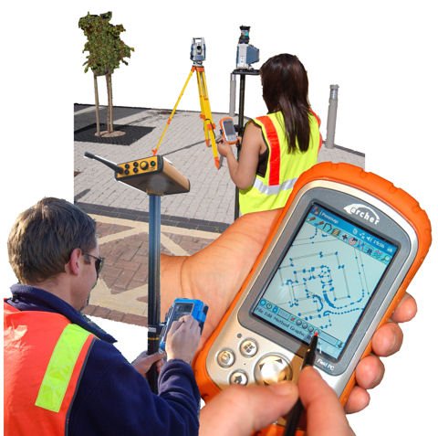
Land Surveyors are professionals who measure and make precise measurements to determine the size and boundaries of a piece of real estate.  While this is a simplistic definition, boundary surveying is one of the most common types of surveying related to home and land owners. If you fall into the following categories, please click on the appropriate link for more information on that subject:

Columbus Land Surveying services:

  1. I need to know where my property corners or property lines are. (Boundary Survey)
  2. I have a loan closing or re-finance coming up on my home in a subdivision. (Lot Survey)
  3. I need a map of my property with contour lines to show elevation differences for my architect or engineer. (Topo Survey)
  4. I’ve just been told I’m in a flood zone or I ‘ve been told I need an elevation certificate in order to obtain flood insurance or prove I don’t need it. (Flood Survey)
  5. I’m purchasing a lot/house in a recorded subdivision. (Lot Survey – See Boundary Survey)
  6. I’m purchasing a larger tract of land, acreage, that hasn’t been subdivided in the past. (Boundary Survey)

If your needs don’t fall into one of the above, don’t worry, we’ll get to the bottom of it. CALL Columbus Land Surveying TODAY at (614) 591-8665 OR better yet, fill out a Contact Form request to discuss your survey needs.

Posted in boundary survey, elevation certificate, land surveying, land surveyor | Tagged boundary survey, FEMA, flood map, Land Surveying, land surveyor

How to Read a Topographic Survey Report

Columbus Land Surveying Posted on May 13, 2026 by ColumbusSurveyorMay 12, 2026

Aerial view of a residential property with contour lines showing elevation changes and drainage flow across the landSo your surveyor just handed you a topographic survey report. You see lines, numbers, and symbols all over the page. At first glance, it may look confusing.

You are not alone. Most property owners feel the same way when they see a topographic survey for the first time. The good news is that once you learn the basics, the report becomes much easier to understand. Knowing how to read it can also help you avoid drainage problems, permit delays, and costly construction mistakes.

Whether you are building an addition, planning a new home, fixing drainage issues, or improving your property, understanding your survey is important.

Why Property Owners Need Topographic Surveys

Property owners often need a topographic survey before starting construction, additions, grading, or drainage improvements. The report helps show elevation changes, water flow, utility locations, and site conditions that may affect permits and construction plans.

Columbus continues to grow quickly. New homes, additions, and redevelopment projects are happening across the city. Because of this growth, accurate site information matters more than ever.

The City of Columbus also has stormwater rules for many construction projects. These rules help control flooding and drainage problems. A topographic survey helps show how water moves across the property before and after construction.

Without accurate topo data, projects may face:

  • Permit delays
  • Drainage issues
  • Utility conflicts
  • Extra grading costs
  • Foundation problems
  • Flooding concerns

The 5 Most Important Parts of a Topographic Survey Report

Contour Lines

Contour lines on a topographic survey connect points of equal elevation and show the slope and shape of the land. Lines close together show steeper ground, while lines farther apart show flatter areas.

Contour lines are usually the curved lines you see across the map. These lines show how the ground rises and falls.

Here is the easiest way to understand them:

  • Lines close together = steeper slope
  • Lines far apart = flatter land

Even though much of Columbus looks flat, many properties still have small elevation changes that affect drainage.

Water may flow:

  • Toward your home
  • Into a low spot in the yard
  • Toward a neighbor’s property
  • Into a drainage ditch or basin

Understanding contour lines can help you spot drainage problems before construction starts.

Contour Interval

The contour interval shows how much elevation changes between contour lines on a topographic survey. Smaller intervals provide more detail and are often used for drainage and grading projects.

Your survey may include a note such as:

  • Contour Interval = 1 Foot
  • Contour Interval = 2 Feet

This tells you how much the elevation changes between each contour line.

A one-foot interval gives more detail and is common for:

  • Residential grading
  • Drainage design
  • Permit applications
  • Site planning

A two-foot interval shows less detail and may not work well for some projects.

If your property has drainage or flooding concerns, ask your surveyor if the contour interval is right for your project.

Benchmark Elevations and Datum

Benchmark elevations show how high different points on the property sit above sea level. Surveyors use a standard system called NAVD 88 to keep measurements accurate and consistent.

Throughout the survey, you may see numbers such as:

  • 893.4
  • 901.7
  • 905.2

These numbers show elevation points across the property.

Elevation matters because even small changes in height can affect:

  • Drainage flow
  • Flood risk
  • Foundation design
  • Retaining walls
  • Flood insurance costs

According to FEMA flood maps, even a small elevation difference may affect whether a property falls inside a flood zone.

If your survey does not list the datum used, ask your surveyor. Elevation numbers are not useful without it.

Existing Features and Utility Symbols

Topographic survey reports also include symbols for features already on the property. These symbols help property owners and contractors understand what is on the site before construction begins.

Your survey may show:

  • Trees
  • Fences
  • Sidewalks
  • Driveways
  • Utility poles
  • Water lines
  • Sewer lines
  • Storm drains
  • Catch basins
  • Existing structures

Pay close attention to underground utilities.

According to Common Ground Alliance reports, underground utility strikes happen thousands of times each year because of missing or outdated site information. Damaging buried lines can create safety problems and expensive repairs.

In Columbus, utility conflicts are one of the most common causes of project delays.

Property Lines vs. Topographic Data

A topographic survey shows land elevations and site features, while a boundary survey legally identifies property lines. A topo survey should not be used to settle property disputes without a separate boundary survey.

This is one of the most common misunderstandings among property owners.

Many people think a topo survey legally confirms property lines. In most cases, it does not.

If you need to:

  • Build a fence
  • Solve a property dispute
  • Confirm boundary locations
  • Build close to a property line
  • Handle an encroachment issue

you will likely need a separate boundary survey.

A topographic survey and a boundary survey serve different purposes, even when both appear on the same plans.

Red Flags to Watch for in Your Survey Report

Before using your topographic survey for permits or construction, check for missing information or signs that the report may be outdated or incomplete.

Watch for these warning signs:

  • No datum listed
  • Missing utility information
  • Old survey date
  • Missing surveyor seal
  • Poor drainage details
  • Contour interval too large for the project
  • Missing easements or drainage structures

In Ohio, surveys used for permits or legal purposes should be signed and sealed by a licensed professional surveyor.

If something looks unclear, ask questions before construction begins. Fixing problems early is usually much cheaper than fixing them later.

Understanding Your Survey Can Save You Time and Money

Reading a topographic survey report may seem difficult at first, but learning the basics can help you make smarter decisions about your property.

A clear and accurate survey can help prevent:

  • Drainage problems
  • Permit delays
  • Construction mistakes
  • Utility conflicts
  • Flooding concerns
  • Costly redesigns

If you are planning a project, getting accurate survey information early can save you time, money, and stress later on.

Frequently Asked Questions 

How long is a topographic survey valid?

Many surveyors recommend updating a topographic survey if it is more than one year old or if site conditions have changed.

Does a topographic survey show property lines?

A topographic survey may show approximate property lines for reference, but it is not the same as a legal boundary survey.

Can a topographic survey show drainage problems?

Yes. Contour lines and elevation points help show how water moves across the property.

Do I need a topographic survey for a home addition?

In many cases, yes. Columbus may require one for additions, grading work, drainage changes, and new structures.

What is the difference between a topographic survey and an ALTA survey?

A topographic survey focuses on land elevation and site features, while an ALTA survey is a detailed commercial property survey used for real estate and development projects.

Posted in topographic survey | Tagged topo surveying, topographic surveying, topographic surveyor

ALTA Survey Guide for Commercial Real Estate

Columbus Land Surveying Posted on May 12, 2026 by ColumbusSurveyorMay 12, 2026

Land surveyor reviewing a commercial property site during an ALTA survey

If your lender or title company just told you that you need an ALTA survey before closing, you are not alone. An ALTA survey is one of the most common requirements in commercial real estate deals, but many buyers do not know what it is until they are already deep into the process.

What Is an ALTA Survey?

An ALTA survey is a detailed land survey used for commercial real estate transactions across the United States. It combines boundary measurements, title research, easement review, and site observations into one certified document. Lenders, title companies, and buyers use ALTA surveys to reduce risk before closing.

ALTA stands for the American Land Title Association. NSPS stands for the National Society of Professional Surveyors. Together, these groups created national standards that every ALTA survey must follow.

That means an ALTA survey completed in Columbus, Ohio follows the same rules as one completed in New York, Texas, or California.

This consistency is important because lenders, investors, and title companies want reliable information. They need to know the survey follows the same standards no matter where the property is located.

The ALTA/NSPS standards were updated in 2026 to improve reporting and make commercial survey information easier to understand.

What Does an ALTA Survey Show?

An ALTA survey shows property boundaries, buildings, easements, encroachments, utilities, and access points. It helps buyers, lenders, and title companies understand the legal and physical conditions of a property before closing.

An ALTA survey gives a full picture of the property instead of only showing boundary lines.

An ALTA survey usually includes:

  • Property boundary lines
  • Buildings and site improvements
  • Easements and rights-of-way
  • Encroachments crossing property lines
  • Utility locations
  • Driveways and access points
  • Fences and visible site features
  • Signs of shared use or occupancy
  • Flood zone information (when requested)
  • Zoning information (when requested)

The surveyor compares what exists on the property with the legal records connected to the land.

This process helps uncover problems before the sale closes.

How Is an ALTA Survey Different from a Boundary Survey?

A boundary survey mainly shows property lines. An ALTA survey goes further by including title research, easement review, encroachment analysis, and site observations needed for commercial real estate transactions.

Many buyers confuse ALTA surveys with standard property surveys.

A boundary survey focuses on identifying the edges of a property. It confirms where ownership begins and ends.

A location survey usually shows where buildings sit compared to the property lines. Residential lenders often require these for home purchases.

An ALTA survey includes both of those services and much more.

An ALTA survey may also include:

  • Title commitment review
  • Easement research
  • Encroachment analysis
  • Access verification
  • Utility information
  • Commercial title insurance requirements

Most commercial lenders require an ALTA survey because title insurance policies often exclude survey-related issues unless a current survey is provided.

Without an ALTA survey, a title policy may not cover:

  • Boundary disputes
  • Easement conflicts
  • Encroachments
  • Access problems
  • Other land issues

That can create major financial risks for buyers and lenders.

Why Do Commercial Buyers Need an ALTA Survey?

Commercial buyers, lenders, developers, and investors often need an ALTA survey before closing. The survey helps identify risks, confirm property details, and meet title insurance and lending requirements.

Commercial properties usually involve larger investments and more legal risks than residential properties.

An ALTA survey can help uncover:

  • Easement conflicts
  • Shared driveways
  • Boundary problems
  • Utility issues
  • Access concerns
  • Encroachments from nearby properties

Real estate attorneys and title professionals often discover these issues during due diligence.

Buyers who commonly order ALTA surveys include:

  • Commercial property buyers
  • Developers
  • Commercial lenders
  • Investors
  • Property owners refinancing commercial property
  • Industrial property buyers
  • Multifamily property buyers

In many commercial deals, title review and survey work happen at the same time to help identify problems early.

What Are Table A Items?

Table A items are optional services added to an ALTA survey. These items expand the survey and provide more detailed information based on the needs of the buyer, lender, or title company.

Not every commercial property needs the same level of detail.

That is why buyers can choose optional Table A items.

Common Table A items include:

  • Flood zone classification
  • Zoning information
  • Parking counts
  • Utility mapping
  • Building measurements
  • Address confirmation
  • Access information
  • Encroachment summary tables

The updated 2026 standards added more detailed encroachment reporting requirements.

Your lender, title company, attorney, and surveyor can help decide which Table A items fit your project.

How Much Does an ALTA Survey Cost?

The cost of an ALTA survey depends on the size of the property, the complexity of the site, and the Table A items requested. Larger and more complicated sites usually cost more because they require more fieldwork and research.

Typical ALTA survey costs:

  • Simple commercial parcels: $2,500–$4,500
  • Mid-size properties: $4,500–$8,000
  • Large or multi-parcel sites: $8,000–$15,000+

Several things affect pricing, including:

  • Property size
  • Number of parcels
  • Existing buildings
  • Site conditions
  • Research requirements
  • Requested Table A items

Although the survey cost may seem high, it is usually much cheaper than dealing with a legal or boundary problem after closing.

How Long Does an ALTA Survey Take?

Most ALTA surveys take two to three weeks to complete. The timeline depends on the size of the property, title research requirements, weather, and the complexity of the site.

Typical turnaround times include:

  • Two to three weeks for standard service
  • Five to seven business days for rush service

Large commercial properties and sites with complicated records may take longer.

One of the most common reasons commercial closings get delayed is that the survey was ordered too late.

How Do You Order an ALTA Survey?

To order an ALTA survey, contact a licensed land surveyor and provide the property address, legal description, and title commitment. Ordering the survey early helps avoid delays during closing.

The title commitment is important because it contains the legal records the surveyor must review.

Information usually needed to start:

  • Property address
  • Legal description
  • Title commitment
  • Title company contact information
  • Requested Table A items
  • Closing deadline

The best time to order an ALTA survey is as soon as title work begins.

Starting early gives the surveyor enough time to complete research, fieldwork, drafting, and revisions before closing day.

Frequently Asked Questions

Is an ALTA survey required?

ALTA surveys are not required for every transaction, but most commercial lenders and title companies require them for commercial real estate deals.

How long is an ALTA survey valid?

There is no official expiration date, but lenders and title companies usually prefer a recent survey that reflects current site conditions.

Can an old ALTA survey be reused?

Sometimes. However, many lenders and title companies require an updated survey before closing.

Who pays for an ALTA survey?

In many commercial transactions, the buyer pays for the survey as part of the due diligence process.

What is the difference between an ALTA survey and a property survey?

A property survey usually focuses on property lines. An ALTA survey also includes title review, easement research, and commercial due diligence information.

Posted in alta survey | Tagged alta survey

How Elevation Certificates Affect Flood Insurance

Columbus Land Surveying Posted on May 8, 2026 by ColumbusSurveyorMay 7, 2026

Raised suburban home near floodwater showing how elevation can affect flood insurance costs

Most homeowners never think about an elevation certificate until someone suddenly asks for one.

Sometimes it happens during a home purchase. Other times, an insurance company requests it before renewing a flood policy. Then the questions start.

Why does the lowest floor matter so much? Why does a basement affect flood insurance cost? And what exactly does this document show?

At first, an elevation certificate may seem like another piece of paperwork. However, it can affect how much you pay for flood insurance and how lenders view flood risk on your property.

That is why understanding it early can save money and stress later.

Why Does the Lowest Floor Matter for Flood Insurance?

An elevation certificate shows how high your home’s lowest floor sits compared to expected floodwater levels. Insurance companies use this information to estimate flood risk. Lower floors, basements, and enclosed areas often increase flood insurance costs because floodwater reaches those spaces first during heavy storms.

Floodwater always moves toward the lowest point first.

Because of that, insurance companies want to know how high your home sits compared to expected flood levels in the area. Even a small height difference can change how risky a property looks on paper.

In fact, even a one-foot elevation difference may affect flood insurance pricing depending on the flood zone and building type.

This is where the lowest floor becomes important.

The lowest floor is not always the main living area. In some homes, it may include a lower room, crawlspace, or basement. Meanwhile, some homeowners assume ground level and lowest floor mean the same thing. They do not.

For example, a home may sit high above the street. Still, a lower enclosed area under the house may count as the structure’s lowest floor.

That detail matters because flood insurance pricing often depends on it.

Lowest Floor vs. Ground Level

Ground level describes where the land sits around the structure. Meanwhile, the lowest floor refers to the lowest enclosed area of the building itself.

That difference may seem small at first. However, it can affect flood insurance calculations in a major way.

What Information Does an Elevation Certificate Show?

An elevation certificate includes the height of the lowest floor, basement, crawlspace, nearby ground elevation, flood zone details, and building type. A licensed land surveyor gathers these measurements to help insurance companies, lenders, and property owners understand how flood risk may affect the structure.

An elevation certificate gives detailed information about how a structure sits on the land.

A licensed land surveyor gathers measurements around the property and compares them to flood data. Then the information goes into a formal document used by insurance companies, lenders, and floodplain officials.

The certificate usually shows:

  • Lowest finished floor elevation
  • Basement or crawlspace height
  • Nearby ground elevation
  • FEMA flood zone classification
  • Building type and structure details

Although the form contains technical information, the goal is simple. It helps show how likely floodwater could reach the structure.

That is why accurate measurements matter.

Why Do Basements Increase Flood Insurance Risk?

Basements increase flood risk because they sit below ground level where water pressure builds quickly. Flood insurance companies often charge higher premiums for homes with below-grade spaces. In many cases, flood insurance also limits coverage for finished basement materials and personal belongings after flooding occurs.

Basements create confusion for many homeowners.

Some people think a finished basement automatically adds value without affecting insurance. However, flood insurance companies see basements differently because they sit below ground level.

Water pressure builds quickly in below-grade spaces. As a result, basements often face higher flood risk.

Even worse, many homeowners learn too late that flood insurance may not fully cover finished basement items.

For example, flooring, drywall, and personal belongings may have limited coverage depending on the policy.

Finished basements often experience some of the highest repair costs after flooding because water damages flooring, drywall, furniture, and electrical systems quickly.

This surprises many buyers after heavy rain or flooding.

That is also why insurance companies look closely at basement elevation when reviewing flood policies.

Why Below-Grade Spaces Flood Faster

Water naturally moves downhill. Because basements sit below surrounding ground level, water pressure builds around the walls faster during storms or drainage problems.

That extra pressure increases the chance of leaks, seepage, and flooding.

Can Crawlspaces and Garages Affect Flood Insurance Cost?

Crawlspaces, garages, and enclosed lower areas may affect flood insurance pricing because they sit closer to floodwater levels. Even unfinished spaces can change insurance calculations if they fall below the main living floor or increase the structure’s overall flood exposure during strong storms.

Basements are not the only concern.

Crawlspaces and enclosed lower levels can also affect flood insurance costs. Even when these spaces stay unfinished, they still sit closer to floodwater.

Some homeowners add storage rooms under raised homes without realizing those areas may affect flood ratings later.

Meanwhile, attached garages can also become part of the discussion if they sit below the main floor.

These details may seem small at first. Still, they can change insurance calculations more than homeowners expect.

How Does Elevation Affect Flood Insurance Pricing?

Homes built higher above expected flood levels often qualify for lower flood insurance premiums. Meanwhile, structures with lower floors closer to floodwater elevations usually face higher insurance costs. Even small elevation differences between nearby homes can create major pricing differences for flood insurance policies.

Insurance companies use risk to help set flood insurance costs.

If the structure sits higher than expected flood levels, the property may qualify for lower premiums. On the other hand, homes sitting lower often face higher costs.

That is why two nearby homes may have very different flood insurance bills.

One house may sit several feet higher even though both homes share the same neighborhood.

In some cases, homeowners overpay because old elevation information still appears in their records. Then later, a new elevation certificate reveals the structure actually sits above flood level requirements.

As a result, updated information may help reduce insurance costs.

Of course, every property differs. Still, accurate elevation data gives homeowners a clearer picture of real flood risk.

Why Do Homebuyers Ask for Elevation Certificates Before Closing?

Homebuyers request elevation certificates before closing because the document helps estimate flood insurance cost and future flood risk. Buyers use this information to avoid surprise insurance expenses, understand basement risk, and review whether the property may face future flooding or drainage concerns.

Homebuyers today ask more questions about flood risk than ever before.

Many buyers do not want surprise insurance costs after moving in. So they often request elevation certificates before closing on a home.

This helps them understand:

  • Possible flood insurance requirements
  • Estimated insurance cost
  • Flood zone concerns
  • Basement flood risk
  • Future resale concerns

Without the certificate, buyers may rely only on flood zone maps. However, flood maps alone do not always tell the full story.

A home inside a flood zone may still sit high enough to reduce risk. Meanwhile, a home outside a mapped flood zone can still experience drainage problems during strong storms.

That is why elevation information gives more useful detail.

Why Older Homes Often Face More Flood Insurance Problems

Older homes sometimes sit lower than current flood standards because builders followed different elevation rules decades ago. Over time, soil settlement and outdated construction methods may increase flood exposure. As a result, older homes often face higher flood insurance costs or additional lender requirements.

Years ago, builders followed different rules. Some homes also settled over time as soil shifted underneath the structure.

As a result, older basements and lower floors may sit closer to flood levels than expected.

This becomes a problem when owners refinance, renovate, or sell the property.

Suddenly, lenders or insurance companies request updated elevation information. Then homeowners discover issues they never noticed before.

That situation happens more often after major storms or updated FEMA flood maps.

Mortgage lenders may require flood insurance when a property sits within a FEMA Special Flood Hazard Area.

Why Homeowners Still Need Elevation Certificates

Homeowners still face flood concerns because strong storms, drainage issues, and low-lying areas can create water problems outside major flood zones. An elevation certificate helps property owners understand how their structure compares to nearby flood levels before insurance, refinancing, or renovation decisions happen.

Many people assume flood problems only happen near large rivers.

That is not always true.

In Columbus, strong rainstorms, poor drainage, and low-lying areas can still create flooding problems. Water may collect around homes even outside major flood zones.

Some neighborhoods also experience drainage backups during heavy storms.

NOAA data shows that heavy rainfall events have increased across many parts of the Midwest over recent decades.

Because of that, flood insurance questions continue to grow across many parts of the area.

An elevation certificate helps homeowners understand how their structure sits compared to nearby flood risk.

That knowledge becomes valuable before buying, refinancing, or planning home improvements.

When Should You Get an Elevation Certificate?

Homeowners should order an elevation certificate before buying, refinancing, renovating, or renewing flood insurance. Early planning helps avoid delays during closing and gives property owners more time to review insurance costs, flood zone details, and possible ways to reduce future flood-related expenses.

Timing matters.

Some homeowners wait until the last minute before a closing date or insurance renewal. Unfortunately, rushed situations create extra stress.

Instead, it helps to order an elevation certificate early if you:

  • Plan to buy or sell a home
  • Need flood insurance
  • Want to refinance
  • Plan major renovations
  • Believe your flood insurance cost seems too high

Early planning gives homeowners more time to review their options and avoid surprises.

Frequently Asked Questions 

What is the lowest floor on an elevation certificate?

The lowest floor refers to the lowest enclosed area of a structure. Depending on the home design, this may include a basement, crawlspace, garage, or lower living area.

Does a basement increase flood insurance cost?

Yes. Basements often increase flood insurance costs because they sit below ground level where floodwater pressure builds quickly during storms.

Can an elevation certificate lower flood insurance?

In some cases, yes. If updated measurements show the structure sits higher than expected flood levels, insurance costs may decrease.

Do homes outside flood zones still need elevation certificates?

Sometimes. Homes outside major flood zones may still face drainage or flooding concerns, especially during strong storms or poor runoff conditions.

Who provides elevation certificates?

Licensed land surveyors typically provide elevation certificates by measuring the structure and comparing elevation data with FEMA flood information.

Posted in elevation certificate | Tagged elevation, flood map, flood zone, flooding

Post navigation

← Older posts
Get Quote Button

Recent Posts

  • How to Read a Topographic Survey Report
  • ALTA Survey Guide for Commercial Real Estate
  • How Elevation Certificates Affect Flood Insurance
  • What a Topographic Survey Shows
  • Why LiDAR Mapping Accuracy Alone Is Not Enough

Categories

  • alta survey
  • boundary survey
  • building survey
  • drone lidar mapping
  • elevation certificate
  • land surveying
  • land surveyor
  • topographic survey
© Copyright Columbus Land Surveying
250 W. Old Wilson Bridge Road, Suite 250
Worthington, Ohio 43085
Terms of Use  |  Privacy Policy
Web Development and SEO by:
N2Biz.co
↑