↓
 

Columbus Land Surveying

...providing land surveying services to the Greater Columbus, OH area.

Columbus Land Surveying Header
Columbus Land Surveying
  • Home
  • ALTA Survey
  • Boundary Surveying
  • Drone LiDAR Mapping
  • Elevation Certificate
  • Land Surveying
  • Lot Survey
  • Topographic Survey
  • Contact Us
Home - Page 2 << 1 2 3 4 5 >>

Post navigation

← Older posts
Newer posts →

What is a Topo Surveyor?

Columbus Land Surveying Posted on February 23, 2017 by ColumbusSurveyorFebruary 11, 2020

Topo Surveying and Topo Surveyor
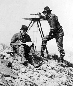
margin: 2px 10px 2px 10px !important; topo surveyorA Topographic Surveyor also known as Topo Surveyor collects the survey data to locate man-made and natural marks and its elevations on a particular portion of land. It normally comprises any man-made underground marks such as utility lines. It will also illustrate ground level installations such as utility poles, buildings, walls, and many other significant installations.

The utilization of standard topographic surveying procedures are commonly employed to provide accurate measured plan of terrain. It is also used during the mapping and graphing phases of projects to blueprint the locations and layout of the installations, road, buildings, and many other engineering and architectural projects in the construction industry.

Why Hire a Topo Surveyor?

The purpose of getting a Topo Surveyor to do topographic survey is to obtain an accurate trace and documentation of the present state of a parcel of land that will be constructed on; either a building, a wall, or any other construction activity. The design engineers make use of the topo survey as they plan the design and then the proposal of the final surface.

It is important to have this plan as this allows the Engineer compute, analyze, and estimate the amount of earth work that might be required. The Engineer will also be able to balance the amount of earth work to minimize the dirt to be taken off and on the construction site. The architect also makes use of the topo survey the same way as the Engineer does.

Additionally, the architect may plot the surface in 3D to picture out the finished look with the improvements he might add. This plot may be presented to the construction owner, building owner, or the land owner before the actual construction takes place. An accurate topo survey is of big help to ensure the installations and improvements fits in on the site within its boundaries.

Common Methods that a Topo Surveyor use
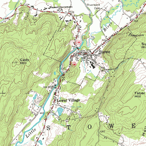
topo-surveyorThe two common methods of doing a topographic survey are Aerial Topo Survey and Conventional Topo Survey. How the topographic survey done would vary on the method the Topo Surveyor use. It is important that a topo surveyor know how to carry out both in any circumstances. So if you will need one, make sure he is professional and experienced both methods.

An Aerial Topographic Survey is done on the airspace. It is taken either in a helicopter or in an airplane at a defined distance above the ground level. Aerial photos of the ground surface are then taken and examined by the topo surveyor. This will allow him to envisage the ground surface through the structure of a stereo pair. By looking at the two overlapping aerial photos, the vantage points are determined.

A Conventional Topographic Survey is done when there is a need to get the accurate contour interval and spot elevations. The Aerial Topographic Survey is limited in the precise vertical and horizontal point location of the ground surface. These are just simplified elaboration of the two methods of topographic survey to provide you an overview. Read and research to learn in depth about them or ask a topo surveyor.

If you need a Topo Surveyor, Please call Columbus Land Surveying today at (615) 591-8665 or fill out a contact form request for more information concerning your land surveying needs.

Posted in land surveying, topographic survey | Tagged columbus land surveyor, Land Surveying, topo surveying, topo surveyor, topographic surveying, topographic surveyor

Flooding From Excessive Rain Downstream From Earth Dams

Columbus Land Surveying Posted on January 2, 2016 by ColumbusSurveyorFebruary 11, 2020

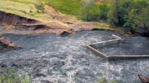
flooding - dam failure - rose hill damThe Daily Republic in South Dakota published an article that talks about an earthen dam that recently failed because of a nine-inch rainfall last 29th of July 2010. The heavy rainfall overwhelmed the dam’s capacity causing it to fail.

No injury was reported on the said event. The said damn was built in 1935, as were a number of them during the Work Programs after the Great Depression. In 2007, it was inspected by a Department of Game, Fish and Parks Engineer and he noted that they “were satisfied with the condition of the dam” during that time. It was then again inspected in 2008 and it was said that the dam breach “was caused by an extraordinary natural event and not by any structural weakness in the dam.” (Photograph by Laura Wehde/The Daily Republic).

Earth dams are almost too numerous to count around the country. In fact, you might just be living near one without you knowing it. A great percentage of these dams were built over 70 years ago and, in many cases, the owners today were not the same ones when they were initially built. For this reason, maintenance and inspection of these dams became less popular.

FEMA estimates “there are over 80,000 dams in the United States”, and that approximately “one third of these pose a ‘high’ or ‘significant’ hazard to life and property if failure occurs.”

The South Fork dam, the country’s worst dam failure disaster in May of 1889, took over 2200 lives and almost half of which were under 20 years old. This incident happened in the town of Johnstown, PA, thus it was known as the “Johnstown Flood”. A 37-foot high wall of water hit Johnstown, located 9 miles downstream from the dam. It almost destroyed the entire city as 1600 homes and 280 businesses was flushed away.

In March 1928, the St. Francis Dam in California also failed. This caused a legislation to be enacted in and around the said state. This, and other later legislation led to life-saving advance warning when the Baldwin Hills dam near Los Angeles, California failed on December 14, 1963. Because of the advance warning which enabled the evacuation of approximately 16,500, the casualties from dam failures has significantly decreased to 5 individuals

Even though there have been far less loss of lives in the United States from dam failures since the 1970’s, The Association of State Dam Safety Officials reports that…

there were 132 dam failures and 434 “incidents” between January 2005 and January 2009.

Of course, It should be noted that the failure of the earthen levees near New Orleans, LA during and after Hurricane Katrina are purported to be responsible for killing more than 1000 people.

Failure in The KaLoko Dam on the Island of Kauai, Hawaii in March 2006 has resulted to the death of 7 people. Two years after the said incident, developer James Pfluegar was indicated for manslaughter and reckless endangerment in relation to the dam failure. The incident had caused the country of Kauai and the State of Hawaii to pay out over $9 Million in of lawsuits after the failure.

Cause of Dam Failures

Heavy rains cause overtopping, which is by far the most common cause of dam failures. Dam spillways and structures are typically not designed for more than a 1-percent chance (aka 100-year) storm event. When a rain event exceeds this, the water starts to travel outside of the control spillway. This causes erosion of the soil on the dam from the excessive amount of water traveling over it. It is also possible for overtopping to occur from smaller rain events because of debris blockage of the outlet structure or spillways or because of settlement of the dam crest.

Foundation defects, including settlement and slope instability, cause about 30% of all dam failures.

Seepage or Piping causes the remaining 20% of the U.S. dam failures. Piping is the internal erosion caused by seepage under and through the dam. This usually happens around structures such as pipes through the dam and spillways. Seepage can also be caused by animals, like beavers, muskrats, groundhogs, and other rodents, burrowing in the dam, by roots of trees growing on the dam, and through cracks in the dam.  All earth dams have seepage resulting from water permeating slowly through the dam and its foundation. But this seepage must be controlled or it will progressively erode soil from the embankment or its foundation, resulting in rapid failure of the dam.

What Should You Do To Protect Home?

Since the failure of a dam causes flood, your best option is to avoid building in a flood zone, unless you elevate and reinforce your home. Have your area surveyed and investigated for dam failure and flood elevation survey so you’ll know if your dream house is safe to be constructed in that certain area.

Do you live downstream from a dam? Is the dam a high-hazard or significant-hazard potential dam? To find out, contact your state or county emergency management agency and/or visit the National Inventory of Dams. There are around 2,228 dams on the National Inventory in Alabama. And among those, 636 are listed as high or significant hazard potential dams.

If you live downstream from one of these dams, find out who owns and regulates the dam. This information should also be available from the National Inventory of Dams.

Next, find out if there is an Emergency Action Plan in place. Again, consult your state or county emergency management agency. (Ohio Emergency Management Agency)

If you want help with investigating a piece of property you are considering purchasing or of one you already purchased, please call Columbus Land Surveying today at  (614) 591-8665 or fill out a contact form request.

Posted in elevation certificate | Tagged dam failure, earth dam, flood, flooding

Using GPS in Land Surveying

Columbus Land Surveying Posted on October 22, 2012 by ColumbusSurveyorFebruary 11, 2020
land surveying

Land surveying is a profession that greatly utilize the GPS system.

land surveyingToday, man-made constellations are in orbit. Their purpose is to provide instant, exact and global positioning information. This global positioning system or GPS is revolutionizing the modern construction sites, automating and guiding land surveying equipment, providing instantaneous circles and volume gap, simplifying total and controlled surveys. Nearly everyone involved in the land surveying and construction industry has heard something about satellite positioning technology or maybe you or someone you know is already using it. Whether an operator or a casual observer, there are still many questions about how this exciting system really works.

These positioning satellites don’t stay in one place like the stars; they orbit the earth about twice a day. Constantly transmitting uniquely identified radio signals that can be perceived by specialized units on earth. These signals are used to precisely measure the distance to the receiving instrument from each satellite visibly overhead.

Just as stars have exact locations in the sky, the locations of the GPS satellites are also defined, becoming orbiting reference points. Using a process based on triangulation, a GPS receiver processes the signals from multiple satellites to compute an accurate position on Earth, which is why it is widely use in land surveying.

For mobile applications that require high accuracy, such as three dimensional machine control, there are two requirements that must be met. First, the signals from a minimum of five satellites must be received at all times. And second, those five satellites must be distributed across the sky. This is called Dilution of Precision or DOP. The simple rule of thumb is this, the more satellites received the better your system will perform.

land surveyingAll land surveying receivers incorporate standard GPS tracking technology; unfortunately the GPS satellite constellation alone cannot continuously make the minimum requirement of accurate mobile positioning. For any given location, there are times in a day when there are less than five available satellites or very poor DOP.

Now, consider a land surveying job site with trees, buildings, or other obstructions when satellite receptions are easily be further reduced. All land surveying GPS receivers suffer this same problem because they all use the same satellites to operate.

Even the planned signal modernization to the GPS satellites won’t solve this problem. An obstruction that blocks one signal blocks all signals from that satellite. A land surveying equipment provider has solved this problem. The solution isn’t adding more signals from the same satellites; it’s adding more satellites.

Today, there is a second positioning satellite constellation in operation, the Glonass System. This positioning system is operated and maintained by the Russian government; much like the GPS is operated and maintained by the United States government; combining these two satellite constellations give land surveyors access to 38 different satellites; 14 more than a GPS-only system.

The additional satellites mean stronger and more accurate positions and better performance in obstructed land surveying areas. These additional satellites mean maximum up time in all land surveying locations, in all conditions.

For an up to date and accurate land surveying service, contact Columbus Land Surveying at (614) 591-8665 or better yet, you may fill out our contact form request and a licensed land surveyor will contact you. 

Posted in land surveying | Tagged columbus land surveying, columbus land surveyor, GPS Columbus, GPS land surveying, GPS land surveyor, Land Surveying, land surveying columbus, land surveyor, land surveyor columbus

Post navigation

← Older posts
Newer posts →
Get Quote Button

Recent Posts

  • How To Find Your Home On FEMA’s Flood Insurance Rate Maps
  • Land Surveyor: Famous Land Disputes All Over the World
  • Welcome to Columbus Land Surveying
  • What is a Topo Surveyor?
  • Flooding From Excessive Rain Downstream From Earth Dams

Categories

  • boundary survey
  • building survey
  • elevation certificate
  • land surveying
  • land surveyor
  • topographic survey
© Copyright Columbus Land Surveying
250 W. Old Wilson Bridge Road, Suite 250
Worthington, Ohio 43085
Terms of Use  |  Privacy Policy
Web Development and SEO by:
N2Biz.co
↑